

Hiking Highlights to Explore
Did you know Connecticut is #1 in the U.S. for hiking? Connecticut has 824 miles of blue-blazed trails, spanning terrain across every region of the state and suitable for every level of hiker. Simply no better way to take in the fresh air — and leave behind the stresses and strains of daily life.
Major Routes
Connecticut’s two main hiking highways are the Appalachian Trail and the New England Trail. The Appalachian is the granddaddy of all trails, running from Maine all the way down to Georgia. Connecticut’s piece is a 52-mile route cutting across our northwest corner; it’s worth seeking out not only so you can say you’ve been on it, but also for the chance you’ll bump into hikers doing the trail’s entire length. The New England Trail runs from the Connecticut coast in Guilford north for 215 miles through 39 towns into northern Massachusetts. Along the way, it mostly uses trails already in existence as part of the state’s blue-blazed system.
Easy Hike Planning
The Northwest Hills Council of Governments have a fully interactive Regional Hiking Trails Map that make it easier than ever to find the challenging climbs, family-friendly hikes and beautiful vistas of the Litchfield Hills.
Blue-Blazed Trails
Connecticut’s blue-blazed trails, maintained by volunteers and administered by the Connecticut Forest and Park Association (CFPA), encompass 825 miles of walkways running through 88 towns. The trails are elegantly described in the CFPA’s Connecticut Walk Book (there are East and West editions), a nearly essential guide if you plan to get out into the woods. But there are other trail systems in the state as well, in state parks, town parks and various natural preserves.

Hikes with Notable Features
- View. If you don’t mind a bit of scrambling, the Mattabesett Trail in central Connecticut offers marvelous views from atop the state’s famous traprock ridges. One of the great vistas comes after a climb up from Meriden’s Giufridda Park to Chauncey Peak. There’s a bit of a scramble to get up to elevation, but once there you’re walking along a ridge from which you can see Hartford to the north, New Haven to the south, and seemingly unlimited views to the west. The descent brings you to a level walk along the lake before closing the loop. This up-and-down hike covers about 2 miles.
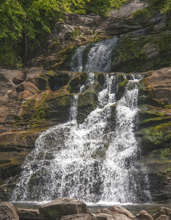
- Waterfall. The southern trail head for the Mattatuck Trail is located in Wolcott’s Peterson Park, just off busy Route 69. Within minutes on the trail, however, the sounds of the outside world begin to fade, replaced by the babbling of the Mad River. Soon you will find yourself in a sort of natural amphitheater, or movie set, with towering hemlocks, filtered sunlight, tumbling and splashing water, and an understory of moss-covered boulders, ferns and mountain laurel. You may want to stay awhile, but if you stick with the trail for another 5 miles, crossing a couple of roads and even passing through a residential neighborhood, you’ll come through a profusion of mountain laurel and eventually to Buttermilk Falls in Plymouth, one of Connecticut’s great secrets in the woods. For this 5.7-mile hike, you’ll have to park one car at the beginning and another at the end.
- History. Rural Roxbury in Litchfield County has a number of natural preserves that are great for hiking, but the most interesting is certainly the Mine Hill Preserve that runs past old iron mines, granite quarries and the ruins of a 19th-century iron-making complex. From the parking area, take a left onto the blue loop trail toward the Donkey Trail. You’ll pass a reservoir, two mine tunnels and a series of grated air shafts, which now serve as entryways to several bat populations. The 4-mile trail continues past massive granite cliffs, eventually descending back to the Shepaug River valley, past an abandoned quarry and finally to the furnace complex, where excellent signage will tell you about all you’ve just seen.
- Salt Water. Most of Connecticut’s state parks along Long Island Sound are big and full of features meant to serve the largest number of visitors possible. Not so with Farm River State Park in East Haven. This is a smallish (62 acres) park that seems unpromising at first but that at length serves as a nice immersion into salt marshes and seaside sights and sounds. As for hiking, the trail lengths don’t amount to much, but you’ll like the places they take you to. Bluff Point Coastal Reserve located in Groton, is one of the last remaining significant piece of undeveloped land along the Connecticut coastline. Jutting out into waters of Long Island Sound this wooded peninsula, measuring one and one-half miles long by one mile wide, encompasses over 800 acres. Great location for a solitary hike along the long, narrow beach.
Find More
Discover more trails across the state with CT Trail Finder, on our hiking page, or find hiking in every county here.
Special Delivery

Connecticut, Delivered Right to Your Fingertips
Share your email address to receive our free newsletter and be the first to see the latest travel deals, attractions and news from CTvisit.com!


